The Group: Cecilie, Hege, Øyvind, Tore, Rune and Bjørn
Our route: Arolla - Cabane des Dix - La Luette - Arolla - Cabane de Bertol - Schönbielhütte - Cabane du Mountet - Cabane Tracuit (2 nights) - Turtmannhütte - Jungen cabel car station.
Tour photos: Open the slideshow
HERE
GPS-tracks may be downloaded
HERE
Our Alp ski tour this year was a good mix of the well-known and new terrain to us. We started with two nights in Arolla (2000). The first touring day we skied via Cabane des Dix to the peak La Luette, trying to acclimatize a bit. During day two and three we followed one of the standard Haute Route options via Cabane de Bertol to Schönbielhütte. From here we continued along Tour du Ciel/Haute Route du Ciel for the next five days. All cabins we staid at belong to the Swiss Alpine Club, SAC (
www.sac-cas.ch). Reservations for our group of six were done on email in January/February.
Since our group does not like too steep or exposed terrain we always went for the safest options. Tour du Ciel is a complex and very nice route. The terrain varies every day, with tall peaks like Dente Blanche (4357) and Weishorn (4506) overlooking it all. The cabins have far less guests then those on the classic Haute Routes. Good weather and snow conditions are crucial since the tour cross high passes, big glaciers and avalanche exposed terrain. We – the happy amateurs – were so lucky, and had full score concerning the weather, the snow and the Group. This is far from normal when ski touring in the Alps.
 |
| 18 April 2018: Arriving Cabane de Tracuit (3256) |
Read more in the day-to-day diary.
Friday 13 April 2018
Believe it or not: It’s not too far from Oslo to the Alps. SAS brings us to Genève Aeroport in 2.5 hours. At the the airport Migros we buy bread, spread and beer, then continue with SBB to Sion. (PS: Buy tickets on SBB.ch online 4 weeks before departure, and get 'Supersaver' discount; CHF 33 instead of CHF 54). After a pit-stop in Sion we continue with the PostAuto Sion to Arolla (2000), the tiny village and ski resort. At 17:30 the six happy ski tourists are checking in at
Chalet les Ecureuils, our home for the next two nights. No lost luggage (unbelievable), high and blue sky, veranda beer and the bunch of good friends. It’s so good to be back in die schöne Schweiz. Tiny Arolla has it all: A place to stay, Nicole & Christoph’s food and wine shop Bazar du Rond-Point (open all days), well equipped Bournissen Sports, restaurant, bus connection and ski lifts. People say it has been the most snowy winter for 30 years. Things look perfect for the coming days.
When it’s time for dinner we go to Restaurant Hotel de Pigne. Very good food. Thanks Benois.
 |
| The PostAuto takes us to Arolla (2000) |
Saturday 14 April 2018
Arolla ski lift (2460) – Cabane des Dix (2928) – La Luette (3548) – Arolla (2000)
↑1200 ↓1700, 7 hours 16 km
Today we go for a daytrip to (La Luette (3548), with light packs. Acclimatisation will be a good thing for lowlanders like us. In addition, we have booked the big dormitory at Les Ecureuils to get acclimatized to each other’s night sounds. Like too many times before I get the hardest morning looks. “Yes, you snore!” Nightmares are soon forgotten when super friendly Roxanne serves müslie, coffee and other goodies at 07:00. And outside the sky is high and blue.
To get a soft start we take the ski lift (opens 08:30, CHF 10 per pers.) up to 2460m, straight into the heart of the Swiss mountain world. It’s more busy then normal, with military personnel planning the coming Patrouille des Glaciers (PDG), the mountain ski race between Zermatt and Verbier. Now they have ‘ploughed’ and marked the trail towards our first goal, Pas de Chèvres (2855), and put up big camps high in the valley. In addition it is weekend and the perfect weather. Pas de Chèvres (2855) we know, including the ladders and stairs below on the west side. We strap skies and poles to our backpacks, climb the stairs and descending the steep and ice hard slope below the ladders with our boot crampons mounted. There are hardly any visible crevasses on Glacier de Cheilon, the snow layer is deep this year. And when arriving
Cabane des Dix (2928) on its proud rock knob we all know what to go for: Rösti. We are in Switzerland now. It’s never tempting to leave the charming hut. Now it is extra hard to do so, since the weather has changed: Clouds are coming in from the west and the wind is rather rough. The good side of this is that we are the only team heading for the top. Well, we stop at the pass SE of the top: Overhanging cornice on the ridge, very flat light conditions – and – we want to be in Arolla before Nicole shuts her shop 18:30. The snow and light conditions are not too exiting skiing down, so we take it carefully. Around 16:30 we are back below Pas de Chèvres. The groomed trail from the pass towards Arolla is icy at first, but as we get lower, it is a pure pleasure to be a skier. All the way down to a cold beer at Restaurante de Pigne at 17:30. And some crucial shopping at Bazar du Rond-Point. After testing the shower and the veranda it is time for a new good treat at Restaurant Hotel de Pigne.
 |
| Crossing Glacier de Cheilon. Cabane des Dix (2928) is waiting for us up on the rock. |
 |
| Rösti on plate and screen. Cabane des Dix (2928) |
Sunday 15 April 2018
It seems like we are a bit acclimatized this morning: Nobody complains about my snoring! Roxanne is waiting with our breakfast at 07:00. As well as some extra bread, cheese and ham we have ordered for our lunch. We are ready for our first ‘real’ touring day along Haute Route and Tour du Ciel. I pay Christoph in Bazar du Rond-Point for our say (CHF 37 per pers. per night, incl. breakfast), then walk down the road to find the trail in and up the Val d’Arolla. It is a high and thin cloud cover today, just below zero and hard snow. We are freshmen on the first part of the stretch today, and don’t mind the many track leading up - and after a while towards SE - to the water intake below Haut Glacier d’Arolla at elevation 2500m (2 hours from Arolla). From here we know the way; this is where the track from Vignettes to Bertol runs. The steep and short climb up to Plans de Bertol is very icy today. My ski crampons, I love you. At Plans de Bertol the PDG crew has put up another tent camp. After a short and friendly chat with some of the men in green we are invited to have our lunch in one the tents. For sure no big luxury, but it’s good to have shelter from the breeze. Just before leaving Samuel (
mountainplanet.ch), the mountain guide responsible for the avalanche safety here, comes over. The friendly guy gives us a lot of useful information about the snow conditions in the area, and confirms that the route from Bertol towards Zermatt is marked with sturdy PDG poles.
The climb up to Bertol is long, but doable if doing it slowly. We are slow, so no problems. The hard crust gives way for powder snow as we get higher, so we manage the last steep and exposed part without ski crampons this time. We are in the clouds now, and it is snow flakes in the air.
Cabane de Bertol (3311), the hut with the craziest setting on Haute Route high on a rock pinnacle. The hut with the long and steep ladder as the crazy main entrance. The cabin is nearly full tonight. 40-50 PDG soldiers - Swiss, French and Germans - stay at the hut, as well as three-four other touring groups. We test our famous trick: Serve smoked salmon (fished by Øyvind) and aquavit to the big and friendly French group, plus hut keeper Anne-Marie Dolivet and her helper. It works again. Soon I have a new French ‘brother’ in Jack. And get useful information from the guide Philipp (
www.guidesvalais.ch). The dinner is not the best, it’s ‘army food carbonara’ from Migros, served on plastic plates. After dinner we order lunch packs for the next day, and pay (cash only). Anne-Marie wants to get a copy of my Haute Route Guide Book for the hut library. I’ll fix that. To bed at 22:00, while the snow is falling outside.
 |
| Skiing up Val d’Arolla, looking in the direction of Cabane des Vignettes (not visible) and Pigne d'Arolla. |
 |
| Getting our orders at Plans de Bertol |
 |
| Cabane de Bertol (3311) has the craziest entrance. |
Monday 16 April 2018
Cabane de Bertol (3311) – Tête Blanche (3710) – Tête de Valpelline (3799) – Schönbielhütte (2694)
↑1050 ↓1600, 7 timer 16 km
Cabane de Bertol (3311). Crazy Cabane de Bertol. You have to have been there to understand it. It’s nothing that matches this place. High above it all on a rocky outcrop. Room and full service for 80 people, run by the fantastic warden legend Anne-Marie Dolivet. The breakfast weather is not the best; thick fog. But the breakfast is great, so is the weather forecast. To be on the safe side we put on our best mountain gear, give Anne-Marie a big Norwegian hug and climb down the long, long ladder. We and the soldiers. Here comes the sun. Everywhere it opens up, making room for the big views.
 |
| Cabane de Bertol (3311) |
The stretch over Glacier du Mont Miné towards Col de Valpelline and down Stockjigletscher is often tricky to navigate. However, today we have the well-marked PDG trail, plus 15-20 soldiers ahead of us making a good trail in the 10 cm of fresh snow toward their camp below Tête Blanche. And high above it all, the sun. We are in no hurry and make the short detour to Tête Blanche (3710) before sliding down to Col de Valpelline. Then we head for Tête de Valpelline (3799). No tracks to see from the top, despite the excellent weather. No tracks coming up from Col de Mont Brulé along the Classic Haute Route, none from Zermatt. Col de Valpelline (3554) is a tiny peak in this terrain, but the view is extraordinary with famous Matterhorn (4478) and proud Dent d’Hérens (4174) as eastern neighbours. We feel so privilege, high above the fog covering Zermatt and the valley.
 |
| Tête de Valpelline (3799). In the back Dent d’Hérens (4174) and Matterhorn (4478). |
Heading back down to Tête de Valpelline I feel like a true skier. The low gradient and fresh snow suit my skills. We pick up our gear, then ski down Stockjigletscher, carefully following the stakes through the crevassed area around 3500m. Time for lunch now, before the lowland fog eats us.
It proves that the fog is only a layer of clouds 3-400 meters thick, the visibility gets back to good below the 3000 contour line, the skiing is superduper. To avoid the tricky moraines below and around Stockji we ski rather in the middle of Zmuttgletscher, until we are at the mouth of the valley below Schönbielgletscher, at elevation 2480m. A bit more to climb to get to the hut, but easier and safer. However, up the “Hüttensteilhang” to Schönbiel nothing comes for free. Today it is steaming hot, and the moraine side is as steep as always. We know there is now running water at the cabin, so a quick snow bath has to do the job. Fresh (?) and happy we slide down to the wonderful and classic
Schönbielhütte(2694), walk inside to give Yolanda the big hug and ask eagerly if she has some Humpe, big beer, for our thirsty group. Yolanda has both Humpen, and one of the best terraces in the Alps. To the south, just across the valley, Matterhorn and Dent d’Hérens ‘block’ the longer view.
 |
| Schönbielhütte (2694) and Matterhorn (4478). Photo by Øyvind Tufto. |
To the SE Monte Rosa, highest of all in Switzerland, is shining. Schönbielhütte, I love it here. “Why not come and work her for a week next year?”, asks Yolanda, when giving us a glass of génépi after the dessert. Yes, why not… (
Schönbielhütte: Cash payment only).
Tuesday 17 April 2018
When planning our tour this is the day I have worried most about. Both weather and snow conditions have to be right to be able to do the crossing over Col Durand between Mattertal and Val de Zinal. The terrain is avalanche exposed and the navigation delicate. The route is long, ascending 1400m, then descending 1200m on the crevassed Glacier Durand. And we are newcomers here. Today the conditions are just perfect. What is not perfect after breakfast is me, standing outside the toilet shed vomiting… Luckily I feel I got rid of what was wrong down there, manage do eat some yoghurt and feel capable to do it.
 |
| Heading up the vallley to Arbengletscher. |
The normal route from Schönbiel to Col Durand goes up along Hohwänggletscher (route 111 on the Arolla 1:50 000 ski tour map,
https://s.geo.admin.ch/7a36d81dec). This rather exposed track is nothing for us, especially now on the very hard morning crust. Instead we go for route 110a and 110b up Arbengletscher. A bit longer, some more meters uphill, but for sure safer. Picking the best track above 2800m and Arbengletscher is not always easy to us, a set of moraines and rocks outcrops make good route finding a bit tricky at times. Suddenly we are in terrain so steep that some need to boot up with crampons and ice axe. And: When dropping a glove there it will go a long, long way down.
 |
| In pass (3408) north of Äbihorn. |
We know. However, this is a fantastic route passing below the foot of majestic Ober Gabelhorn (4063), with the very best views towards Matterhorn, Monte Rosa and the Mischabel mountains like Alphubel and Rimpfischhorn. Arbengletscher itself is like a stroll (despite a bit thin air), and during this ‘snowful’ winter hardly any open crevasses. From the pass (3408) north of Äbihorn we ski down 150m to Hohwänggletscher, then skin up to Col Durand (3436). Voila, from here it’s (nearly all) downhill. From now on it is payback time. The snow is excellent up here, powder. The bergschrund below us, warned about in ski tour guides, is hardly visible. The sun is out. Wind speed is zero. Skiing down Glacier Durand is a real treat. The last leg of the day is skinning up the steep moraine below the cabin. Not as high as the Schönbiel climb, still 100 vertical meters under the baking sun makes it into a real “Hüttensteilhang”.
 |
| On the moraine below Cabane du Mountet (2886), looking at Dent Blanche (4357). |
Cabane du Mountet (2886) is another classic and good SAC cabin, from where we have a magic view towards Dent Blanche (4357), Glacier Durand and tons of other goodies. Perrine Grand, the hut warden, shines like the sun and checks that everybody have a good time. We get our own room; the hut is only half-full. I buy a Coke to treat my stomach, and go for a siesta: It has been a long and challenging day eating only one orange and one energy bar… Despite being a bit slack: This is for sure one of the nicer trips to do in the area.
Dinner is served at 18:30, like at most of the SAC cabins. I’m longing for a beer, a true sigh of slowly coming back to life. Before the evening is over we have got four new mountain friends: The two young German/Austrian couples Barbara & Johannes and Julia & Philipp, doing Tour du Ciel without a guide. (Mounet: Cash payment only).
 |
| Cabane du Mountet (2886). Photo by Øyvind Tufto. |
Wednesday 18 April 2018
A new calm and bright morning meets us for breakfast at 06:00 (no options for a later setting), and Øyvind who tells us that last night he had to run out to throw up… Nearly all other groups set off for Cabane Arpitettaz (2786) via the exposed ridge to Blanc de Moming / Dôme (3651), route 565a 111 on the Arolla 1:50 000 ski tour map;
https://s.geo.admin.ch/7a36d9d7ce. Once more, we pick a safer but longer route. I have to realize that I’m not very good reading maps. It’s hard to admit for topographer Bjørn. What I thought would be more like a transfer stage proved to be a really great tour, though a bit backwards compared to what I’m used to: Today we descended first,
then climbed up.
 |
| Looking back towards Glacier de Zinal. |
From Cabane du Mountet (2886) our day starts with a long ski run down Glacier de Zinal (route 95a), all the way down to elevation 1900m. On smooth and good morning crust. Pure pleasure. Down in the larch forest we put on our skins, make some odd detours because of big old wet snow Avalanches, and start the looooong but trouble-free climb up to Cabane de Tracuit (3256). This is for sure no transfer stage, this is a dream tour day. Stunning mountains wherever I look, the dramatic Glacier de Moming the south, the Val Zinal down below. Now it is Cecilie’s time not feeling well, while Øyvind is back to strong again. In the last long and hot climb towards the cabin Tore and Øyvind establish their new company: “Fjellgeita sekkeservice/The Mountain Goat Back Pack Service”, immediately proving their quality by shuttling Cecilie’s and their own backpacks all the way up to the Col de Tracuit.
 |
| Skitouring in grand terrain, heading for Cabane de Tracuit (3256) |
They also tried to assist the totally exhausted 76 year old man up in the hillside as well, but may have to work a bit more on their French before succeeding.
Cabane de Tracuit (3256) is a modern hut built in 2013, on the top of the mountain ridge. The cabin has 120 beds, today though it is no more than 30-40 guests, so we get a big nice room for our group. After ordering some beers we head for the rough ‘sun deck’ outside, next to Barbara & Johannes and Julia & Philipp. Time for some reindeer sausage and aquavit, and cheers for Barbara & Johannes: This is their honeymoon travel.
 |
| Cabane de Tracuit (3256). |
18:30 it is dinner time at the top of the world. Hut warden Anne-Lise Bourgeois and her crew (Tania, Maria and xxx) know how to run a place like this. Thank you so much. We like it here. Good to know that we have booked two nights. (Tracuit: Credit card payment option; check when booking).
Thursday 19 April 2018
Cabane de Tracuit (3256) – Bishorn (4151) – Cabane de Tracuit (3256)
↑900 ↓900 5 timer 8 km
Day tour day! Light backpacks. Blue sky. The Swiss flag on the pole hides away the white cross, it is dead calm at 3200m. Breakfast 07:00 (despite Anne-Lise being a bit sceptic to such a late start) with fresh bread, müslie porridge, juice and coffee. What have we done to deserve this?
Today our plan is named Bishorn, 4151 meter high. Not much else to say about the tour then a classic, good peak tour. The snow might not be the best, icy crust in the start, sastrugi/wind eroded snow nearer the peak. We ski all the way up to the small plateau on the ridge east of the summit, then do the last short, steep snow slope with boot crampons and ice axe. We rather used to the altitude now, so Bishorn (4151) is very doable. The top itself is flat and comfortable. The wind is absent. The sun is high up there. The view feels like endless: Far towards SW we see the characteristic dome of Mont Blanc, with Grand Combin a bit closer. To the north: All the peaks in Berner Oberland. South of us Weishorn (4506) shines high and white. More to the east we have Dom (4545), Täschhorn, Alphubel, Rimpfischhorn, Monte Rosa (4634) and Liskamm. Skiing down the first part – on the wind eroded snow – is not fun. Coming lower the sun has transformed the crust into perfect snow for us. This is how I like to ski!
 |
| Bishorn (4151), with view towards Dom (4545), Täschhorn, Alphubel, Rimpfischhorn and Monte Rosa (4634). |
Back at Tracuit we order rösti for lunch, and it indoor to be out of the burning sun. Lips, ears and face have had more than enough now, despite hat, sun block and creams. For me it is time for a siesta, while Tore and Rune make an afternoon new tour to Tête de Milon (3693) SE of the cabin. Dinner 18:30. Since Swiss mountain huts not are famous for having a cozy corner for a night cup adjust to that and go to bed rather early.
 |
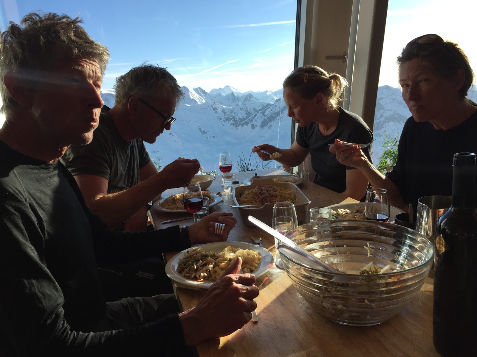
| Cabane du Tracuit (3256), meal with a view. |
Friday 20 April 2018
Cabane du Tracuit (3256) – Brunegghorn (3833) – Turtmannhütte (2519)
↑1050 ↓1800 7 timer 17 km
 |
| Saying au revoir and merci to the grat Tracuit Team. |
From Tracuit to the next cabin, Turtmannhütte, it is not very far. 3 hours will do. Since the weather has parked in the sunny and calm mode, we decide to do the detour option to Brunegghorn (3833). At 07:00 we are ready for breakfast, in the big and bright main room. Like all recent mornings all by ourselves, nearly. An elderly man – even older than 1955 model me – is having his meal next to us. Communication is close to zero; he looks straight into is cup, has a very bad hearing and problems when talking. We can’t win them all.
It’s time to say goodbye to the wonderful Tracuit Team, with big hugs and promises of coming back soon. Merci beaucoup Anne-Lise! From the cabin we start skiing on hard crust down Turtmanngletscher. The steeper part is safe due to the thick snow layer, so compared to the route drawn on the ski tour map – and my downloaded GPS track – we keep more to the middle: Down to the big plateau around 2800m. Ahead of us Brunegggletscher waits, loooong and even for the next 4 km.
 |
| Slowly up Brunegggletscher, heading for Brunegghorn (3833). |
We should have brought our ‘universalklister’; the combo of crust and skins makes me feel like skiing on sandpaper, so our progress is rather slow. Around 3150m we leave most of our stuff packed in our bivouac sack, secures it with a shovel and a snow anchor, and head for the steeper part. Hege has not her favourite day today, so she decides to stop and wait for us. The rest of us zigzag slowly up to the icy – and windy – pass 3646m, SW of the peak. For us boot crampons and ice axes are the only option further on. We are not keen to ski this exposed ridge, neither up nor down.
 |
| On the ridge down from Brunegghorn (3833). |
The Brunegghorn (3833) top is not very wide, so we move carefully up there. But the view is wide. And deep, deep below – 2500 vertcal meters – the traffic work it’s way up and down Mattertal. If I’m sick again, or just uncomfortable with the exposed ridge, I don’t know. Anyhow I don’t contribute too much heading down to find our skis. But from here I feel fine again. The (careful & slow) skier in me is back. First we ‘find’ Hege, then the bivouac sack with all our goodies. And head on down Brunegggletscher. We pick the ‘alternative’ route (150a on the ski tour map, towards Gässi and the big cairn marking the summer trail. With good conditions the steep couloir might be used, but not today. The snow is very soft, and below the traverse further on to the cabin looks avalanche risky now. Therefore, we ski down to the main track to SW (route), and ski down the wider gully, like route 12b/150b indicates. Check the map
here.
 |
| View towards Turtmanngletscher fromTurtmannhütte (2519). |
At
Turtmannhütte (2519) it is love at first sight. What a place: The classic old hut, with a newer extension, the huge sunny terrace, the superb setting and the warm and friendly crew. Brigitta & Chiara, thanks for the way you receive us and treat us. Our young German/Austrian ski touring friends are here. And we get some new; the Italian group from Bologna/Rimini (Valentina, Paolo, NN, NN). Cold beer from Chiara. Reindeer sausage from our backpack. Taking in the grand view of the Turtmanngletscher icefall. From here it simply like crazy that we passed on top of it this morning. The dinner at 18:30 trumps it all, the best meal during our long tour. A very happy and satisfied bunch slips into the sheet bags that night. (Turtmann: Cash payment only).
 |
| Turtmannhütte (2519). |
Saturday 21 April 2018
Turtmannhütte (2519) – Jungen cabel car (1990)
↑1050 ↓1800 6 timer 12 km
When I looked down on the terrain we will ski today, from Brunegghorn, I thought it look a bit more ‘boring’ than what we had skied so far. I was so wrong. The ski tour from Turtmannhütte to the Jungen cable car has is all: Varied, challenging, grand views, tricky climbs and long descends. It is for sure a fair weather route, navigation is far from straight forward.
We go for breakfast at 06:00, the latest option here. The young German/Austrian quartet has already left the building. At 07:00 our new Italia friends wave arrivederci, heading for Tracuit. We are ready half an hour later. The morning is clear & calm, the snow rock hard, like we’re used to by now. High above Pipjitälli, the valley east of the cabin, the steep rock face Üssers Barrhorn (3610) is the most dominant feature. Like a mini version of Half Dome in Yosemite, California. It is a very pleasant route to ski, as the sun sneaks over the peaks in east.
 |
| Pleasant morning up Pipjitälli. Photo by Øyvind Tufto |
The last climb towards pass 3050 on Längi Egga is steep. We strap skis to our sacks and to it with ice axe and crampons. Cecilie and Tore just
have to climb Pipjispitz (3078), the rest of us prepare for the semi steep skiing down into Brändjitälli. The long traverse climbing gently towards the ridge NNW of Stellihorn proves to be rather scary on the rock hard snow. Even with the ski crampons on. It would have been wiser to do it on foot, with boot crampons, or skied closer to the 160b line on the ski tour map. But, well assisted by ‘Fjellgeita sekkeservice’ we manage. The next climb, and our final, to the pass Jungtaljoch (3220) is for sure ‘skis on the backpack terrain’. It is crucial to find the correct point for crossing. However, today it is all piece of cake with good footsteps follow. The snow is soft here now, we’re hot. After 8 full touring days I may live with no more descends for some days or weeks.
 |
| In the pass Jungtaljoch (3220). Junggletscher below to the right. |
On the NE side of Jungtaljoch (3220) snow and wind have made a perfect terrace to get the crampons away and the skis on. From here it is downhill to Jungen, a fantastic and joyful long slide. The steeper part below Junggletscher/3000m we handle easily. As we get lower the snow gets very soft and wet. All over there are big, old wet avalanches. I understand why SLF still keep danger level 4 for such. Spring is in the air, or better summer, as we ski – and walk some parts – along the road through the larch forest down to the tiny alp Jungen (1990). The cable car to Sankt Niklaus (
www.jungenbahn.ch) is waiting for us. Since it takes only four passenger at the time Hege, Tore and Øyvind take the first one. I go with the second, together with two locals. On our tour everything has been according to plans, until now. Missing only the last 50 meters before reaching the valley station the gondola stops with a big jerk. Full stop. Engine system dead. The next hour gets very, very hot in the tiny gondola greenhouse, I tell you. Finally the staff manage to switch on the emergency power, and are able to bring us down. Cecilie & Rune are still up there at Jungen, 900 vertical meters above Sankt Niklaus, for two more hours… The rest of us jump on the train and head for Visp,
Hotel Elite, a beer and a shower.
Finally, around 18:45, we are all gathered outside Hotel Elite. Beatrice, who I met last summer hiking around Monte Rosa, has invited us to her wine yard in Visperterminen, just above Visp. These are the highest wine yard in Europe. Because of the cable car trouble we have to cancel such a visit. Instead, Beatrice comes to us, in Visp, bringing the rare white wine she and the cooperative produces: The Heida wine, made on the grape Savagnin blanc (not Sauvignon blanc). Now it is time for dinner at Barock, we are starving. Beatrice serves the Heida, crips and cold an wonderful. Thank you so much for meeting us, and for bringing your wine. Before leaving we have ordered main dishes twice.
 |
| The happy last meal in Visp! |
What a perfect way to celebrate our eight adventurous ski tour days in the Swiss mountains. We managed it once more, thanks to the fantastic group – plus full score for weather and snow.
Sunday 23 April 2018
Heading home: Cecilie with train to Frankfurt, the rest of us with
SBB to Zürich Flughafen (PS: Buy tickets on SBB.ch online 4 weeks before departure, and get 'Save daypass' discount; CHF 52 instead of CHF 93), and then with the SAS 14:40 flight to Oslo.
Tusen takk turen Cecilie, Hege, Øyvind, Tore og Rune!
 |
| RUNE, HEGE, ØYVIND, TORE, CECILIE, BJØRN |


.JPG)




%20Piazza%20Armerina%20Sicilia.JPG)


