torsdag 28. juni 2018

2018 Tour du Beaufortain

GRP (Grand Randonnée Pays) Tour du Beaufortain
↑6580m ↓5500, 106 km, 50 hours, 9 days

My Tour Slide Show: Click
Map of Beaufortain and our route: Click
The GPS track: Click

Walking in France is tempting - again and again. This summer we headed for Beaufortain sitting SW of Mont Blanc and NE of Albertville, to do a hut-to-hut tour 1 - 9 July 2018. Five women. Five men. A big group for sure, but since we all know each other well we just wanted it this way.
Our tour was a close copy of the guidebook GRP (Grand Randonnée PAYS) Tour du Beaufortain, except for starting/ending at the 'wrong' spots, and missing out a small part to make the complete circle. Our tour started from Les Contamines-Montjoie and ended in Praz-sur-Arly, both places SW of Chamonix, with rather easy access from Genève Aeroport (1.5 hours with the pre-booked shuttle from Alpybus, www.alpybus.com). As I understand it, most people start the GRP from Queige.

Beautiful Beaufortain, here at Lac d'Amour (2248). In the back the characteristic landmark La Pierra Menta (2714)

Beautiful Beaufortain - famous for (and very proud) of it's Beaufort cheese - is situated NE of Albertville and SW of Mont Blanc (4810). Along parts of the trail runs through rather gentle & pleasant meadow like terrain, close to summer farms and ski resorts. In the northern area, around fancy and charming Refuge de Presset, the terrain is rougher, wilder and more challenging. And very beautiful. Around Queige (550) the trail runs through forest, as it also does near the lake Lac de St-Guérin (1512). 

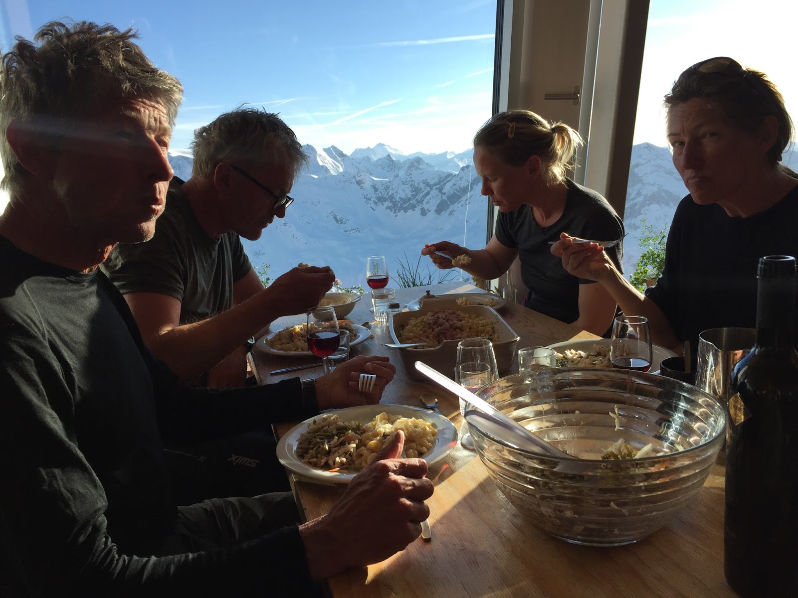
On the way we stayed at mountain cabins and at one gîte (more like a pension). When hiking in early July it's not many other hikers around in Beaufortain, except along the short part in NE which followed the busy trail of Tour de Mont Blanc. All places were booked in advance. Even in the quiet start of July this is recommended for big groups like ours. All cabins had staff and served good meals. All the way we slept in dormitories/multi bed rooms. Some places rather simple. Some places close to luxury. The only village we went through (day 7) was tiny Queige. Along our main trail the highest elevation was Crête des Gittes (2538), just south of Refuge Col de la Croix du Bonhomme (day 3). The highest point we visited was Tête nord des Fours (2756), north of the same cabin. 

Tour description - day by day

Sunday 1 July 2018
With a slightly delayed flight with Norwegian from Oslo 07:25, we arrive Genève Aeroport 10:15. From GVA we continue with our booked Alpybus (www.alpybus.com) shuttle to Les Contamines-Montjoie (1.5 hours). Price for 10 persons: 260 €, where we had booked a table at Le Chalet du Lac. An excellent place for our summer lunch on the terrace. We go for salads and burger under the blue sky. 

Les Contamines-Montjoie (1175) – Refuge de la Balme (1706)
↑530 ↓50 7 km, 2.5 hours
Refuge de la Balme: www.montourdumontblanc.com. Payment: Cash only.

On the road to Refuge de la Balme

At 14:30 we're ready to start our rather short hike from Les Contamines-Montjoie to Refuge de la Balme, all the way on a good gravel road. Perfect for running shoes. It's a very nice and pleasant walk, up through the forest first, then in more open terrain. This stretch is part of the most popular and famous of all Alp hikes: The TMB (Tour du Mont Blanc) Trail, and GR5 (Grand Randonnée 5), the famous long distant trail running from the North Sea to the Mediterranean. At 'half way' we stop for some snacks at super-friendly and beautiful Alpinus Lodge, just below Refuge de Nant Borrant (1460).
Refuge de La Balme (1706) is like a summer farm, surrounded by meadows and cattle. Rather basic, but nice and clean. We get a dormitory in the basement, and cold beers served in the 'garden'. A very, very nice place to be. Dinner is served at 19:00, for us and a bunch from South Korea.

Refuge de la Balme (1706)

Monday 2 July 2018
Refuge de la Balme (1706) – Refuge du Col de la Croix du Bonhomme (2443)
↑750 ↓50 6 km, 3 hours
Refuge du Col de la Croix du Bonhomme: http://lerefugedubonhomme.free.fr. Payment: Cash only.

At La Balme a typical French breakfast is served at 07:00; white bread, jam, honey and café au lait. We ask for some extra cheese to 'survive', but they have no extra for us this morning.
At 08:00 we wave goodbye to La Balme and the colourful Korean Team. The TMB trail we follow today is well beaten. Here you'll seldom walk alone. The weather is super, the landscape as well. We are well above the tree line now, the alpine valley is very green and fresh. The winter has been extraordinary hard and long this year, and it is still early summer. The result is an extreme amount of mountain flowers, including carpets of azaleas. And firm snow patches here and there covering the trail. Getting higher we get the barren mountain side of Aiguilles de la Pennaz to our right. The TMB trail climbs steadily towards snow covered Col du Bonhomme (2329), where a tiny shelter is built. Could be very useful if weather is cold or wet. However, today we take our short snack stop under the blue sky.

Above Col du Bonhomme (2329)

From Col du Bonhomme the trail climbs up the snow covered hillside, towards SW, to the crest (2479) just north of Refuge du Col de la Croix du Bonhomme (2443). The big cabin is very busy, but friendly. We take a rest outside the big cabin, waiting for the lunch service to start at 12:30: Excellent quiche and salad. And glasses of beer for the 'brave' ones.
After lunch we get our two rooms, then repack a bit before going for our 2-3 hours 'afternoon hike' to Tête nord des Fours (2756) and Tête sud des Fours (2716). From the peaks it is grand views to Mont Blanc (4810), when the clouds stay away... We get some glimpses before the huge mountain takes on the grey hat. Back at the Bonhomme cabin we have time for more relaxing - and ibex /bouquetin /steinbukk spotting - before dinner is served at 19:00. The cabin is very crowded, with hikers from all over the world. I'm impressed of how the staff manage to run this place. So efficient, so friendly. Our new friend today is Hilmar from Iceland, taking a group of his countrymen/women along TMB.

Refuge du Col de la Croix du Bonhomme (2443). Big, busy and friendly.

Tuesday 3 July 2018
Refuge du Col de la Croix du Bonhomme (2443) – Gîte de Plan Mya (1860) – Refuge de Presset (2504)
↑1100 ↓1000 18 km, 8 hours
Gîte de Plan Mya, www.refuge-mya.com  Payment: Cash only.
Refuge de Presset, https://refugedepresset.ffcam.fr  Payment: Cash only.


If dinner was chaotic at Bonhomme I don't know how to describe the breakfast. It is free seating at the long tables, and hectic both among hikers and staff as we start to eat at 06:30. Outside it is foggy and chilly, so we put on some extra layers this morning. Most of the hikers will follow the TMB main trail from Bonhomme, running eastwards (two options) from the cabin. We are heading south, along the far more quiet trail GR5/GRP Tour du Beaufortain, picking the variant along the mountain ridge Crête des Gittes (2538).

Crête des Gittes

At 08:00 we are ready, all 10 of us, more or less wind and 'fog proof'. The trail over Crête des Gittes is really unique - and recommended - following the ridge like a snake. Maybe not the best choice if you don't like it to airy, but the track is more like a narrow road, carved into the mountain. The fog soon dries off around us, soon we are walking on top of the clouds and enjoying the fantastic landscape. As we continue down and westwards to pass Col de la Sauce (2307) we follow the smaller trail on the grassy crest top. Very nice it is.
From Col de la Sauce the marked trail runs down through gentle meadows, partly on gravel road, to the asphalt road D925. Nearly no traffic today on this early July morning. Along the road there are two options for food and lodging: Refuge du Plan de la Lai (FFCAM) and Gîte de Plan Mya (private). We have booked an early lunch at Gîte de Plan Mya (1860), tempted by their web page menu. It proves to be a very good choice! Plan Mya proves to be some much more than a menu card: A very warm welcome the chef Yvon and her crew. The beautifully restored house. And then the food! We start with the specialty of the house: Snails in a green herb mix.  Then quiche, home made sausage, salad, potato/apple pate, blueberry pie, coffee... Fantastic! Nothing but good, good, good. A place I really have to visit again. A hard place to leave. PS: Plan Mya accept cash only.

Flower power at Le Grande Berge.

At 12:15 it is back on the track again, leaving Plan Mya behind. We still have a long way to go today, now along GR5. From Plan Mya (1860) the trail runs over the two low passes Le Petit Berge and Le Grande Berge (ca 2050). The green meadows are covered with with carpets of white flowers (sorry, don't know the name). After Le Grande Berge the trail zigzag down a bit, and leads through low forest to a crest. Here we have a good view towards the next hiking stretch, and the characteristic mountain and landmark La Pierra Menta (2714). From the crest we walk downwards now, to approx.1800 m. From here on it is all uphill to the next pass, Col du Bresson (2469). First rather steep (and hot) through low forest, then through rocky fairytale terrain (and a welcoming breeze). All the way on a good trail. From the pass we look over to our goal for the day: Refuge de Presset (2504), sitting on its rock knob.  We are in real mountain terrain now. In the valley below we spot 10-15 ibexes grazing. It is still a lot of snow up here, and the small lake next to the cabin nearly covered with ice. We skip the swim plan, and go for the showers - and a cold beer at the terrace.

Col du Bresson (2469). Cabane de Presset (2504) in the back.

Modern Refuge de Presset (2504) immediately gets a place on my top-ten-list. The setting is the very best. The cabin, built in 2013, is a true masterpiece; the light and functional main room, the multi bedrooms, the huge terrace. And to top it all: The guardians Sandra de Bersacques and Sebastian! Thanks a lot for the way you receive us, the way you treat us!!! You make us feel at home from the very first moment. The delicious Presset dinner is served at 19:00. A perfect way to finish a long, beautiful and varied hike.

PS Thanks to advice from Sandra, on the phone, we did not walk via the valley to the north, Combe de la Neuva. It's doable, but is still rather snow covered.

Wednesday 4 July 2018
Refuge de Presset (2514) – Refuge de La Coire (2059) – Refuge de l'Alpage (1983)
↑1000 ↓1050 17 km, 7 hours
Refuge de La Coire: https://lacoire.weebly.com/ Payment: Cash only.
Refuge de l'Alpage: restaurant.alpage@wanadoo.fr. Payment: Card or cash.


Another beautiful day is waiting for us as we sit down for breakfast at 07:00. Like every day we ask for extra ham and cheese. Of course Sandra & Sebastian fix it. We are heading for Refuge de l'Alpage today, via Refuge de La Coire. The standard route option would be to backtrack via Col du Bresson (2469), drop down 400 meters along the trail we came last evening and then head for Col du Coin (2398). However, thanks to advice from my friend Bernard Lefauconnier (and a French group at Presset), we choose to go via Passeur de la Mintaz (2600). This pass, also named Col de Tutu, is situated just north of La Pierra Menta (2714). But, before the warm au revoir hugs at my new favorite cabin we just have to walk around the Lac Presset and take photos.

Refuge de Presset (2504) and La Pierra Manta (2714)

At 08:30 we're on our way. Since the long and strong winter has left the hillside rather wet the trail towards Passeur de la Mintaz is rather slippery and tricky. And for sure enough  steep and exposed for a guy like me. The walking sticks are very useful. We soon catch up with the French group, where the 'boss' takes very care about both his friends and our group over the most slippery dirt parts. (One guy prefers to use his crampons. It doesn't look like a very good idea...)

Finding the way to Passeur de la Mintaz/Col de Tutu.

We all make it safely to Col de Tutu. My concern about how steepness and snow conditions are on the west side of the pass is really waste of energy; the slope is gentle and the firm snow makes it perfect to descend. Time to time we look more like happy kids skiing down on our boots, nearly all the way to the lake with the charming name Lac d'Amour (2248). Despite very cold water (I give it 5°C) and a breeze three out of ten just have to go for a quick dip. In the "water of love" :-)

Lac d'Amour (2248)

From Lac d'Amour we head for Col du Coin (2398), where we will be back on the classic GRP Tour du Beaufortain. The terrain is back to green and gentle again, and the walking is straight forward and pleasant. Towards the pass a group of mountain bikers are struggling to get their horses up the hill, happy to get a Norwegian arm or two assisting a bit. The grownup mixed group - more or less at our age - is out on a longer Trans Alp tour. Here and now I vote for boots.
From the pass we walk down and into a new (to us) green valley, partly on trail, but mainly on gravel road (bike please!). We head for Refuge de La Coire (2059), where we have booked table for lunch (payment in cash only). No booking is needed today, only a few others are out walking or biking. The hot lunch plates we order are OK, however we have other cabins we'll rather come back to. 

Above Lac de St-Guérin (1512)

Heading westwards from La Coire the GRP follows the gravel road for nearly 1 km, then continues on good trail down towards the lake/reservoir Lac de St-Guérin (1512). The upper part runs over meadows, then through the forest the very last part. At the SE bay of turquoise colored Lac de St-Guérin our trail passes over a fancy suspension bridge, then along a popular "stroll road" along the south shore. After a short snack rest, cooling our feet in the creek ("swimming prohibited"), a 450 meters climb is waiting for us. The day is hot, so it is a real treat to walk in the shady and beautiful forest for the first 300 meters uphill.

Refuge de l'Alpage (1983)

Refuge de l'Alpage (1983) sits on the grassy ski resort hillside, and is accessible by car (dirt road). The huge veranda is close to empty today. Guess it is rather lively here during the ski season. The cabin is newly renovated, from top to toe. And the owner - Patricia - for sure knows how to run the business: Perfect food and lodging. And, according to our plan our friend Bernard arrives in his car from Grenoble/Chartreuse. For the next day our group will consist of 11 happy hikers. 
Out there clouds, rain showers and thunder are coming in, hiding Mont Blanc. But suddenly, just before bedtime it is there, the beautiful giant of the Alps.

Thursday 5 July 2018 
Refuge de l'Alpage (1983) – Le Grand Mont (2686) – Refuge des Arolles (1890)
↑950 ↓1050 13 km, 6-7 hours
Refuges des Arolles: https://lesarolles.org/ Payment: Card or cash.

After a very good breakfast at Refuge de l'Alpage (07:00) most of us are ready for a local beauty: The mountain Le Grand Mont (2686). It's a bit cloudy outside, and the peak is playing with the fog. We pack a light sack, and give it a try. The trail is mainly well marked, but higher up snow is still covering the path and marks. Up high the terrain gets more and more Nordic. Not steep, but snowy and barren. Yes, we like it here. The clouds still play around the top while we are there, but partly sunny weather and no wind make this top tour to a good choice.

Le Grand Mont (2686)

We're back at Refuge de l'Alpage around 12:00, for 'stress down' and a good lunch. When we're ready to leave Refuge de l'Alpage it is already 14:30. The trail and landscape towards Refuge des Arolles is simply very, very nice. Really beautiful. Wild, always changing, lush. With exception of a few mountain trail runners we are all alone. Again. The highlight to me is the area near Lac Tournant; the wild scenery, the creek draining down into the hillside, the tiny gorge below the pond. It's a true pearl sitting here between all build out ski slopes. Just before arriving Refuge des Arolles (1890) our standard tour equipment, the umbrellas, become handy. Finally. 

Near Lac Tournant.

Refuge des Arolles (1890) is friendly, basic and warm. This evening we - "the bunch 11" - get a warm welcome. The combination of 10 Norwegians and one French is obviously not what they're used to. Des Arolles The dinner at 19:00 is tiptop. The 'boss' and her crew are helpful and caring. I really like it here, despite being more or less in the middle of a ski track.

Refuge des Arolles (1890)

Friday 6 July 2018
↑450 ↓1400 13 km, 3 hours
Gîte de Molliessoulaz: http://www.gite-beaufortain.com/gite/. Payment in cash.

At 07:00 it's a classic French breakfast at Refuge des Arolles. Since we have a rather long walk ahead of us without any huts en route we have ordered lunch packs. Outside the weather is gray and a bit wet. We wave goodbye to the cabin, and say au revoir to Bernard. He will walk back to his car at l'Alpage, then drive and stay with us one more night at Molliessoulaz.

Rain Men

It's rain gear and umbrella conditions today, and most of the day we walk in the clouds. Shortly after leaving Arolles we are out of the forest, and walk in open terrain for the next hours. At the pass Col de la Bâthie (1889) a few people are out waiting for a mountain race. We are a bit too early to be a cheering team, so the herd of grazing cows is the only the entertainment for us this morning. From the pass the trail drops a little bit before it climbs 400 meters up to Col des Lacs (2247). No conditions for swimming in Lacs de Lavouet, they are covered by ice and fog. From Col des Lacs the trail follows the rather steep west flank of Pointe de la Grande Journée (2460), and takes us about 200 meters lower. On the map the trail is drawn as "passage délicat", but I find it easy to walk. No worries.

Starting the descend towards Gîte de Molliessoulaz.

The fog still keeps out what must be great views to the south, all way over the pass east of La Roche Pourie (ca 2020). From now on it's down, down about 1000 m before our day is over. First through pleasant azalea covered terrain, then into the forest. Apart from a bunch of goats we meet nobody. Pick a grey day in the Alps, and the chance for a quiet day is good. We have booked places at Gîte de Molliessoulaz, and as we approach the weather clears up. And after a while the sun is shining.
Gîte de Molliessoulaz (950)
At Gîte de Molliessoulaz (950) the sun is not needed. The reception we get by Sébastien, the owner, is simply fantastic. Our French is not the best ("Je parle français comme une vache espagnole!"), his English comme si comme ça. A perfect setting for warm hugs and good laughs. And cold beers out in the nice garden. We get the two big and nice rooms upstairs, and then hot showers. Bernard turns up in his car, and a bit later Claire; the warm lady of the house. The evening is more then perfect, with plenty of very good food and wine. Before it's all over we have been served champagne at the balcony, watching at the moon - and Mont Blanc. Thank you Claire and Sébastien for the very generous way you are treating us! Gîte de Molliessoulaz: Strongly recommended.

At Gîte de Molliessoulaz they know how to treat their guests. 

Saturday 7 July 2018
Mini bus service from Gîte de Molliessoulaz  (950) to Queige (540)

Queige (540) – Refuge du Lachat (1555)
↑1300 ↓200 15 km, 7 hours
Refuge du Lachat: www.refugedulachat.com Payment: Credit card or cash

Breakfast - with very good bread - is served at 07:30. To save our sore morning legs it's easy to say yes to Sébastien's offer to drive us down to the village Queige, for a few euros only. I really don't like the idea about leaving this nice house, but we have to stick to our plan today. After hugs and kisses (luckily it takes time since we are 11) we roll down the hill. Sébastien in front, Bernard behind.
In charming Queige with we shop some fruit and snacks in the tiny grossary (entrance via the bar). Queige has bus connection to/from Albertville, and is the starting point for those doing Tour du Beaufortain according to the FFRandonnée guidebook. At 09:30 we say goodbye to Bernard, driving back home to Sappey en Chartreuse, and hit the trail.

Along GRP Tour du Beaufortain towards Refuge du Lachat.

This is the least spectacular day on our tour. The trail stays in the forest most of the time, more or less all the way to Refuge du Lachat. It's no easy to find good, open spots for a picnic. The big views are not too many. Parts of the forest is big, old and nice, and keep out the sun on a warm day like this.
At Refuge du Lachat (1555) the sign "Fermé/Closed" and a locked door meet us . Is something wrong with my booking? The place is dead quiet. A window is soon open above us: "I'll come down in a minute". Guess we hit the local siesta hour. For sure we are a bit ahead for the summer rush, not much action around in early July.
Lachat is clean and OK, with a huge terrace. The warden is not very eager doing his job, but we do get what we need: Cold beers, coke and salty snacks. Today it's just us and two others staying for the night. It mus be different in the winter peak season I guess; the west and north side of the hill above us is peppered with ski lifts.
The dinner at Lachat  - at 19:00 - is very good and plentiful. I go to bed early, my old body is a bit slack tonight.

Refuge du Lachat (1555)

Sunday 8 July 2018
Refuge du Lachat (1555) – Refuge de la Croix de Pierre (1965) – Refuge Le Petit Tétras (1783)
↑900 ↓600 17 km, 7 hours
Refuge de la Croix de Pierre: www.refugedelacroixdepierre.fr. Payment: Cash only. 
Refuge Le Petit Tétras: Booking on Facebook. Payment: Credit card or cash.

07:00 means breakfast time, before preparing for our last full walking day. From Lachat we walk a bit downhill, before walking 400 meters uphill through pleasant forest towards the hill Chard du Beurre. And huge, grassy, open ski resort fields. At Col de la Lézette (1787) we just have to stop at tempting Le Benetton: They sell Italian ice cream and very good coffee!
From Col de la Lézette (1787) the GRP follow the dirt road now, with a few exceptions, up to Col de Véry. Running shoes would have been the best choice on this stretch. Or a bicycle. This is grazing land for cattle. As well as ski resort country. On our way we pass a bigger constriction site, more apartments for the skiers I guess.
All the way towards Col de Véry we have a fantastic view over the green valley bellow, and snow covered Mont Blanc (4810) high above to the east.

And high above it all: Mont Blanc (4810)

Our lunch stop, Refuge de la Croix de Pierre (1965), is a very charming place. Both the house and the owners. It's busy this sunny Sunday, not too easy get an outdoor table for our big group. However, after a while we both table, tasty salad on the plates and cold stuff in our glasses. Hiking in France is not bad at all.

Refuge de la Croix de Pierre (1965).

At Col de Véry / La Croix de Pierre we leave the GPR Tour du Beaufortain and head northwest towards our last cabin on this tour. This trail is very pleasant, with good views all the way: Most of the time we walk on the crest of the hill, via Mont de Vorès (2067), Ban Rouge (1983) and Crêt du Midi (1890), to arrive at a very good place to be: Tiny and charming Refuge Le Petit Tétras (1783), run in a very nice way by Julie and Mathias, with their family.


On the ridge from Mont de Vorès (2067) to Ban Rouge (1983).

We get the big dormitory on the attic, and the 'private' top terrace behind the house. Some aperitif, a shower, then it is dinnertime: The food is tiptop. And the 'dessert' beautiful: The last glass of wine on the main terrace as the daylight slowly fades out. Le Petit Tétras: The perfect place to spend the last evening up high.

Refuge Le Petit Tétras

Monday 9 July 2018
Refuge Le Petit Tétras (1783) – Praz-sur-Arly (1010)
↓800 5 km, 2 hours 


Today we have to be down in the valley before 10:00 to catch the minibus we have booked. As breakfast is ready for us at 07:00 we've backed most of our stuff, and are ready to start walking at 07:45. Au revoir Petit Tétras! This was a very memorable stay to all of us.

Refuge Le Petit Tétras (1783)

The 800 meters descend to village Praz-sur-Arly goes very smooth; the trail is never very steep as it zigzags through the forest. Down in Praz-sur-Arly we have plenty of time to buy some local goodies (Beaufort cheese and sausage) and re-pack a little bit before our prebooked Alpybus arrives in front of Le Mairie/Town Hall at 10:00.

Descending towards Praz-sur-Arly.

Praz-sur-Arly, like our starting point Les Contamines-Montjoie, is just an 1.5 hours drive away from Genève Aeroport. Just ideal for busy tourists like us, flying home to Norway around 14:00.

- o O o -

Beaufortain: 
An area which is very easy to recommend! Fantastic hiking terrain, full of superduper mountain cabins. And in early July: Hardly any other hikers.

My good friends: 
Such a perfect company, day after day!
Up hills and down hills.
Sunshine or rain.
Let's do it again!

Tusen takk for turen, fra Bjørn.


Emergency number France: 112


søndag 27. mai 2018

2018 A six days hike from Tende to Menton, France

Hiking the Nice Hinterland

Photos from our trip: Click HERE.
Our GPS track is available HERE.
Google Earth file of the trip: Click HERE.

Click for big map
This is a perfect hike to do when the snow still blocks the higher mountain passes for walkers, and the mountain cabins are closed. All the way the trails run well below the treeline. All the way you stay in charming, old villages. All the way you walk on well-marked trails. Apart from one exposed short section, as GR 52A descends to Breil-sur-Roya (alternative route possible), this is a fairly straight forward walk. Only occasionally you'll meet other walkers.

The highest point of our hike: 1200 m
Walking distance per day: 10-16 km. 
Walking time per day: 5-6 hours, or less.
 

To open the French Map Service click here.

Berghe Supérieur
The hike described below took place in mid May 2018, after an extremely long and snowy winter. The weather conditions were still on the cool and wet side (fresh snow down to 2000 m one morning).  Despite this, all trails were dry and good for hiking, with plants in full bloom. A very pleasant hike for sure! 

We booked our unguided tour from www.france-ecotours.com, who describes the tour like this:
“This hike leads you through the most beautiful villages of the French Riviera and the hinterland of Nice. You walk alone on an almost forgotten path, that used to be the most important route for the salt business. From the mountains you climb down to the sea, crossing valleys and pass, perched villages, pine forests and olive groves”.


12 May 2018
The airliner Norwegian brings us from Oslo to Nice airport in 3 hours (09:10-12:05), then bus 98 to Nice city centre. Excellent lunch at Peixes, 4 rue de l’Opera, a stroll in the old town, relaxing at the beach. At 17:13 we take the train www.sncf.com from Gare de Nice Ville to Breil-sur-Roya. Due to work on the railroad we have to continue from here with bus to Saint-Dalmas de Tende, and Hôtel Le Prieuré. Clean, nice, simple style. Dinner around 19:30. Only a few other walkers are here, and for one reason or the other, they are all Scanidnavian: Helene, Reidar, Grete and Fredrik from Norway. Karin and Roland from Sweden.

13 May 2018
Saint-Dalmas de Tende – La Brigue  – Tende
↑600 ↓500, 10km, 3 hours
Aftre a short climb up from Saint-Dalmas de tende we walk along a good and flat trail through the forest from Saint-Dalmas de Tende to charming, old La Brigue, and a Coke. From here in ‘treeless’ terrain to Col de Loubaïra. We miss the trail north of the pass, and end up walking down the asphalt road… When reaching the main road we follow the smaller road on the west side of the river La Roya all the way to the village.
The old part of Tende is “glued” onto the hillside. A bit shabby, very dead, but charming & fascinating. In the newer part of the village we have an excellent lunch at Le Gourmand - “chez Eliane”. Recommended!  Outside it’s raining heavily now. We find our umbrellas, take a walk up above the old town. Back again on the main street we catch bus 905 back to or hotel in Saint-Dalmas de Tende. (Option: Hike along “Chemin des Bois” from Tende to St-Dalmas).

Tende
14 May 2018
Saint-Dalmas de Tende – Fontan
↑500 ↓700, 14 km, 5 hours
Bus: Fontan – Saorge
The day starts by walking 1 km along the main road south of the village. From here we hike mostly along pleasant trails to the tiny hamlet Granile. The small bar is closed when we arrive, but the superfriendly keeper living next door opens up the business, making us café au lait - and sandwiches for our lunch stop. From Granile the trail takes us to the largest village on this hill, beautiful Berghe Supérieur. From the village we follow the tarmac for 850m, the continues on a good and nice forest trail to tiny Berghe Inférieur. Time for our lunch next to the trail, under our umbrellas. From the village we follow the road for about 1 km, before dropping 300 vertical meters down the rather steep trail to hairpin road D42. On asphalt 3 km to Fontain, the last 700m along mainroad D6204. It has been raining for the last hour now, and my sore achilles does not want more pepper. I’m happy that we arrive Fontan just in time to catch bus 905 and not walk the last 2 km of asphalt road walk up to Saorge. (Walking option: Walk 1.2 km southwards along D6204, before following the old zigzag path/dirt road that ends south of the tunnel on road D38 to Saorge). Saorge village, clinging to the hillside, is a real adventure. Exciting to explore. We stay at the very pleasant Ca'Da Barrera (http://chambresdhotes-saorge.fr), run by friendly Lucas. In addition to being a clever cook he knows how to handle the accordion as well.

Saorge
15 May 2018
Saorge – Breil-sur-Roya
↑500 ↓700, 10 km, 5 hours
After breakfast we buy baguette, cheese, ham and wine at the grocery shop. Today’s walk starts next to our hostel Ca'Da Barrera. The yellow marked and excellent trail takes us down to the main road D6204. Since the footbridge across the river Bendola is missing we have to walk the 650 m long road tunnel. Not very pleasant, however it is both sidewalks and light inside the mountain. Immediately south of the tunnel we walk down the road towards the river, cross under the main road, and are ready for the first climb of this leg. The track starts with a dirt/crushed stone road, the joins GR 52A on a rather rough (we are a bit spoiled by now) but good trail up through the forest, with some good viewpoints. We have our lunch stop on the nice rock crop north of Vallon de Zouayné, looking down towards Breil-sur-Roya. GR 52A is rather overgrown as we get close to Breil-sur-Roya, with some very exposed/steep sections. (Alternative if scared of high drops: Follow yellow marked trail through the forest down to La Pinède, towards the railway station). Breil-sur-Roya is a compact, classic mountain town of the 17th/18th century. At this time of the year it is dead quiet, but contains what we need: Atmosphere, hotel, bar and grocery. We stay at Hôtel Le Roya. Despite the helpful and friendly keeper, it will not be amongst my favourites. Dinner at 19:30 at Restaurant La Bonne Auberge, while a heavy hailstorm – with peanut size nuggets – sweeps over the village.

View towards Breil-sur-Roya
16 May 2018
Breil-sur-Roya – Piène Haute – Sospel
↑650 ↓600, 15 km, 6 hours
Before leaving Breil-sur-Roya we buy classic French lunch stuff at the supermarket next door. For the first 1 km the nice trail follows GR 510, then continuing along yellow marked trail towards the village Piène Haute. A very beautiful and pleasant hike, through old olive groves and with nice views most of the way. On very good trails. The village Piène Haute is a real pearl. Colourful houses along the “main road”, the Baroque church on the cliff edge. My only wish is that somebody had run a café here. From Piène Haute we follow the tarmac for one flat kilometre, then continue on GR 510 though olive groves on gravel road, 2 km/250 vertical metres down towards the Italian border and tarmac road D93 between Sospel and Olivetta. After a short stretch on asphalt, we follow the very nice “salt road” along the river La Bévéra: First high above the impressing/scary gorge, the along the flat river bank. After crossing below the railroad brigde Le pont de Caï, the 3 km walk to Sospel is 50/50 on asphalt/trail. The rain sets in. We love our umbrellas, again. And our two new Swedish friends walking the road: Ulrica and Leif. In Sospel we stay at wonderful Auberge Provencale, sitting on the hillside south of the village. A very good place to be. We put up a long table for our "group", the hiking 4 Swedes and 6 Norwegians.

Piène Haute
17 May 2018Castillon Village – Sainte-Agnès
↑650 ↓600, 13 km, 6 hours
Bus: Sospel - Castillon Village

Today we have to catch bus 15 to Castillon Village, leaving Sospel at 10:00. After breakfast we walk charming and "tourist empty" Sospel. Once this was a prosperous village, situated on the important salt route the transporters had to pay toll here. We buy some goodies for lunch, and find the bus stop. The bus ride to Castillon Village takes 10 minutes. We follow the three first bends up through the village, then continue on the yellow marked and good trail (not indicated on the French topo maps) to Col the Castillon. The trail from here towards Mount Ours (Bear Mountain/Bjørnfjell) is very well made, nearly like a road. I’m not the biggest fan of walking in the woods, but this one I find very pleasant. We skip the short detour to Mont Ours (1216), to save my sore foot. The trail further on – and down – is obviously part of the fortifications on Mont Ours and Pic de Garuche. At the trail bend at alt. 1100 m, with a big view towards the Mediterranean, we decide to stop for lunch. Unfortunately the rain coming in makes us change plans. Umbrellas instead of baguette and rosé. The descend towards Col de Verroux and Col des Banquettes is hard on my feet: The only parts left of the military road are the gutters/kerbstones, the old road surface is washed away during the years. What remains is rough and loose gravel. I’m happy for the straps I brought for tying the umbrella to my backpack, so that I may still use both my walking poles. The last levelled 1 km of today’s walk follows asphalt or dirt road, aiming for Sainte-Agnès which “waving to us” up on it’s hill. The sun is suddenly back. Sainte-Agnès is another real pearl, with old houses, narrow alleys, big views, and our Hôtel Le Saint Yves. The rooms may not be the very best, it smells ‘start of the season’, but the crew is friendly and helpful. Dinner at 19:30. Since it is our National Day today, we go for a bottle of champagne. Hipp, hipp hurra for 17. mai :-)
Trail towards Mont Ours - Bjørnfjellet :-)

18 May 2018
Sainte-Agnès – Castellar – Menton
↑200 ↓850, 15 km, 4 hours
Sunny and good as we leave pretty Sainte-Agnès, aiming for Menton at the sea. Today’s hike follows GR 51 on good and well-marked trails down to the villages Monti and Castillar, through fascinating and wild terrain. At this time of the year, after several days with some rain, it is green, lush, blooming. Castellar is very quiet when we arrive, no café open. We find the tiny grocery in Rue de la Republique, and have our lunch in the park. From Castellar we walk only 500m on asphalt, then continues on pleasant trails down towards highway A8, following yellow marks. Now we are approaching the busy and popular Côte d'Azur and the city of Menton. The very last 2-3 km are on asphalt, on the road on top of la Colle, with fancy summerhouses and ocean view.
Our six days walk is soon to an end. We walk slowly down through the colourful and beautiful old town of Menton. Then we stop at the beach. Grateful and happy for all our experiences on this very pleasant hike from Tende to Méditerranée.

Sainte-Agnès – Monti

Menton

Méditerranée & man

søndag 29. april 2018

2018 Tour du Ciel - The Sky Tour - himmelturen

The Group: Cecilie, Hege, Øyvind, Tore, Rune and Bjørn

Our route: Arolla - Cabane des Dix - La Luette - Arolla - Cabane de Bertol - Schönbielhütte - Cabane du Mountet - Cabane Tracuit (2 nights) - Turtmannhütte - Jungen cabel car station.

Tour facts: 8 days, ↑9200 ↓11500, 100 km. 
Tour on map: Open the Swisstopo map
Tour photos: Open the slideshow HERE
GPS-tracks may be downloaded HERE

Our Alp ski tour this year was a good mix of the well-known and new terrain to us. We started with two nights in Arolla (2000). The first touring day we skied via Cabane des Dix to the peak La Luette, trying to acclimatize a bit. During day two and three we followed one of the standard Haute Route options via Cabane de Bertol to Schönbielhütte. From here we continued along Tour du Ciel/Haute Route du Ciel for the next five days. All cabins we staid at belong to the Swiss Alpine Club, SAC (www.sac-cas.ch). Reservations for our group of six were done on email in January/February.
Since our group does not like too steep or exposed terrain we always went for the safest options. Tour du Ciel is a complex and very nice route. The terrain varies every day, with tall peaks like Dente Blanche (4357) and Weishorn (4506) overlooking it all. The cabins have far less guests then those on the classic Haute Routes. Good weather and snow conditions are crucial since the tour cross high passes, big glaciers and avalanche exposed terrain. We – the happy amateurs – were so lucky, and had full score concerning the weather, the snow and the Group. This is far from normal when ski touring in the Alps.
18 April 2018: Arriving Cabane de Tracuit (3256)

Read more in the day-to-day diary. 

Friday 13 April 2018
Believe it or not: It’s not too far from Oslo to the Alps. SAS brings us to Genève Aeroport in 2.5 hours. At the the airport Migros we buy bread, spread and beer, then continue with SBB to Sion. (PS: Buy tickets on SBB.ch online 4 weeks before departure, and get 'Supersaver' discount; CHF 33 instead of CHF 54).  After a pit-stop in Sion we continue with the PostAuto Sion to Arolla (2000), the tiny village and ski resort. At 17:30 the six happy ski tourists are checking in at Chalet les Ecureuils, our home for the next two nights. No lost luggage (unbelievable), high and blue sky, veranda beer and the bunch of good friends. It’s so good to be back in die schöne Schweiz. Tiny Arolla has it all: A place to stay, Nicole & Christoph’s food and wine shop Bazar du Rond-Point (open all days), well equipped Bournissen Sports, restaurant, bus connection and ski lifts. People say it has been the most snowy winter for 30 years. Things look perfect for the coming days. 
When it’s time for dinner we go to Restaurant Hotel de Pigne. Very good food. Thanks Benois. 
The PostAuto takes us to Arolla (2000)

Saturday 14 April 2018
Arolla ski lift (2460) – Cabane des Dix (2928) – La Luette (3548) – Arolla (2000)
↑1200 ↓1700, 7 hours 16 km
Today we go for a daytrip to (La Luette (3548), with light packs. Acclimatisation will be a good thing for lowlanders like us. In addition, we have booked the big dormitory at Les Ecureuils to get acclimatized to each other’s night sounds. Like too many times before I get the hardest morning looks. “Yes, you snore!” Nightmares are soon forgotten when super friendly Roxanne serves müslie, coffee and other goodies at 07:00. And outside the sky is high and blue.
To get a soft start we take the ski lift (opens 08:30, CHF 10 per pers.) up to 2460m, straight into the heart of the Swiss mountain world. It’s more busy then normal, with military personnel planning the coming Patrouille des Glaciers (PDG), the mountain ski race between Zermatt and Verbier. Now they have ‘ploughed’ and marked the trail towards our first goal, Pas de Chèvres (2855), and put up big camps high in the valley. In addition it is weekend and the perfect weather. Pas de Chèvres (2855) we know, including the ladders and stairs below on the west side. We strap skies and poles to our backpacks, climb the stairs and descending the steep and ice hard slope below the ladders with our boot crampons mounted. There are hardly any visible crevasses on Glacier de Cheilon, the snow layer is deep this year. And when arriving Cabane des Dix (2928) on its proud rock knob we all know what to go for: Rösti. We are in Switzerland now. It’s never tempting to leave the charming hut. Now it is extra hard to do so, since the weather has changed: Clouds are coming in from the west and the wind is rather rough. The good side of this is that we are the only team heading for the top. Well, we stop at the pass SE of the top: Overhanging cornice on the ridge, very flat light conditions – and – we want to be in Arolla before Nicole shuts her shop 18:30. The snow and light conditions are not too exiting skiing down, so we take it carefully. Around 16:30 we are back below Pas de Chèvres. The groomed trail from the pass towards Arolla is icy at first, but as we get lower, it is a pure pleasure to be a skier. All the way down to a cold beer at Restaurante de Pigne at 17:30. And some crucial shopping at Bazar du Rond-Point. After testing the shower and the veranda it is time for a new good treat at Restaurant Hotel de Pigne. 

Crossing Glacier de Cheilon. Cabane des Dix (2928) is waiting for us up on the rock. 

Rösti on plate and screen. Cabane des Dix (2928)


Sunday 15 April 2018
Arolla (2000) – Cabane de Bertol (3311)
↑1340, 5-6 timer 9 km
It seems like we are a bit acclimatized this morning: Nobody complains about my snoring! Roxanne is waiting with our breakfast at 07:00. As well as some extra bread, cheese and ham we have ordered for our lunch. We are ready for our first ‘real’ touring day along Haute Route and Tour du Ciel. I pay Christoph in Bazar du Rond-Point for our say (CHF 37 per pers. per night, incl. breakfast), then walk down the road to find the trail in and up the Val d’Arolla. It is a high and thin cloud cover today, just below zero and hard snow. We are freshmen on the first part of the stretch today, and don’t mind the many track leading up - and after a while towards SE - to the water intake below Haut Glacier d’Arolla at elevation 2500m (2 hours from Arolla). From here we know the way; this is where the track from Vignettes to Bertol runs. The steep and short climb up to Plans de Bertol is very icy today. My ski crampons, I love you. At Plans de Bertol the PDG crew has put up another tent camp. After a short and friendly chat with some of the men in green we are invited to have our lunch in one the tents. For sure no big luxury, but it’s good to have shelter from the breeze. Just before leaving Samuel (mountainplanet.ch), the mountain guide responsible for the avalanche safety here, comes over. The friendly guy gives us a lot of useful information about the snow conditions in the area, and confirms that the route from Bertol towards Zermatt is marked with sturdy PDG poles.
The climb up to Bertol is long, but doable if doing it slowly. We are slow, so no problems. The hard crust gives way for powder snow as we get higher, so we manage the last steep and exposed part without ski crampons this time. We are in the clouds now, and it is snow flakes in the air. 
Cabane de Bertol (3311), the hut with the craziest setting on Haute Route high on a rock pinnacle. The hut with the long and steep ladder as the crazy main entrance. The cabin is nearly full tonight. 40-50 PDG soldiers - Swiss, French and Germans - stay at the hut, as well as three-four other touring groups. We test our famous trick: Serve smoked salmon (fished by Øyvind) and aquavit to the big and friendly French group, plus hut keeper Anne-Marie Dolivet and her helper. It works again. Soon I have a new French ‘brother’ in Jack. And get useful information from the guide Philipp (www.guidesvalais.ch). The dinner is not the best, it’s ‘army food carbonara’ from Migros, served on plastic plates. After dinner we order lunch packs for the next day, and pay (cash only). Anne-Marie wants to get a copy of my Haute Route Guide Book for the hut library. I’ll fix that. To bed at 22:00, while the snow is falling outside.

Skiing up Val d’Arolla, looking in the direction of Cabane des Vignettes (not visible) and Pigne d'Arolla.
Getting our orders at Plans de Bertol
Cabane de Bertol (3311) has the craziest entrance.


Monday 16 April 2018
Cabane de Bertol (3311) – Tête Blanche (3710) – Tête de Valpelline (3799) – Schönbielhütte (2694)
↑1050 ↓1600, 7 timer 16 km
Cabane de Bertol (3311). Crazy Cabane de Bertol. You have to have been there to understand it. It’s nothing that matches this place. High above it all on a rocky outcrop. Room and full service for 80 people, run by the fantastic warden legend Anne-Marie Dolivet. The breakfast weather is not the best; thick fog. But the breakfast is great, so is the weather forecast. To be on the safe side we put on our best mountain gear, give Anne-Marie a big Norwegian hug and climb down the long, long ladder. We and the soldiers. Here comes the sun. Everywhere it opens up, making room for the big views.
Cabane de Bertol (3311)
The stretch over Glacier du Mont Miné towards Col de Valpelline and down Stockjigletscher is often tricky to navigate. However, today we have the well-marked PDG trail, plus 15-20 soldiers ahead of us making a good trail in the 10 cm of fresh snow toward their camp below Tête Blanche. And high above it all, the sun. We are in no hurry and make the short detour to Tête Blanche (3710) before sliding down to Col de Valpelline. Then we head for Tête de Valpelline (3799). No tracks to see from the top, despite the excellent weather. No tracks coming up from Col de Mont Brulé along the Classic Haute Route, none from Zermatt. Col de Valpelline (3554) is a tiny peak in this terrain, but the view is extraordinary with famous Matterhorn (4478) and proud Dent d’Hérens (4174) as eastern neighbours. We feel so privilege, high above the fog covering Zermatt and the valley.
Tête de Valpelline (3799). In the back Dent d’Hérens (4174) and Matterhorn (4478).
Heading back down to Tête de Valpelline I feel like a true skier. The low gradient and fresh snow suit my skills. We pick up our gear, then ski down Stockjigletscher, carefully following the stakes through the crevassed area around 3500m. Time for lunch now, before the lowland fog eats us.
It proves that the fog is only a layer of clouds 3-400 meters thick, the visibility gets back to good below the 3000 contour line, the skiing is superduper. To avoid the tricky moraines below and around Stockji we ski rather in the middle of Zmuttgletscher, until we are at the mouth of the valley below Schönbielgletscher, at elevation 2480m. A bit more to climb to get to the hut, but easier and safer. However, up the “Hüttensteilhang” to Schönbiel nothing comes for free. Today it is steaming hot, and the moraine side is as steep as always. We know there is now running water at the cabin, so a quick snow bath has to do the job. Fresh (?) and happy we slide down to the wonderful and classic Schönbielhütte(2694), walk inside to give Yolanda the big hug and ask eagerly if she has some Humpe, big beer, for our thirsty group. Yolanda has both Humpen, and one of the best terraces in the Alps. To the south, just across the valley, Matterhorn and Dent d’Hérens ‘block’ the longer view.
Schönbielhütte (2694) and Matterhorn (4478). Photo by Øyvind Tufto.
To the SE Monte Rosa, highest of all in Switzerland, is shining. Schönbielhütte, I love it here. “Why not come and work her for a week next year?”, asks Yolanda, when giving us a glass of génépi after the dessert. Yes, why not… (Schönbielhütte: Cash payment only).

Tuesday 17 April 2018
Schönbielhütte (2694) – Cabane du Mountet (2886)
↑1400 ↓1200 8 timer 15 km
When planning our tour this is the day I have worried most about. Both weather and snow conditions have to be right to be able to do the crossing over Col Durand between Mattertal and Val de Zinal. The terrain is avalanche exposed and the navigation delicate. The route is long, ascending 1400m, then descending 1200m on the crevassed Glacier Durand. And we are newcomers here. Today the conditions are just perfect. What is not perfect after breakfast is me, standing outside the toilet shed vomiting… Luckily I feel I got rid of what was wrong down there, manage do eat some yoghurt and feel capable to do it.
Heading up the vallley to Arbengletscher.
The normal route from Schönbiel to Col Durand goes up along Hohwänggletscher (route 111 on the Arolla 1:50 000 ski tour map, https://s.geo.admin.ch/7a36d81dec). This rather exposed track is nothing for us, especially now on the very hard morning crust. Instead we go for route 110a and 110b up Arbengletscher. A bit longer, some more meters uphill, but for sure safer. Picking the best track above 2800m and Arbengletscher is not always easy to us, a set of moraines and rocks outcrops make good route finding a bit tricky at times. Suddenly we are in terrain so steep that some need to boot up with crampons and ice axe. And: When dropping a glove there it will go a long, long way down.
In pass (3408) north of Äbihorn.
We know. However, this is a fantastic route passing below the foot of majestic Ober Gabelhorn (4063), with the very best views towards Matterhorn, Monte Rosa and the Mischabel mountains like Alphubel and Rimpfischhorn. Arbengletscher itself is like a stroll (despite a bit thin air), and during this ‘snowful’ winter hardly any open crevasses. From the pass (3408) north of Äbihorn we ski down 150m to Hohwänggletscher, then skin up to Col Durand (3436). Voila, from here it’s (nearly all) downhill. From now on it is payback time. The snow is excellent up here, powder. The bergschrund below us, warned about in ski tour guides, is hardly visible. The sun is out. Wind speed is zero. Skiing down Glacier Durand is a real treat. The last leg of the day is skinning up the steep moraine below the cabin. Not as high as the Schönbiel climb, still 100 vertical meters under the baking sun makes it into a real “Hüttensteilhang”.
On the moraine below Cabane du Mountet (2886), looking at Dent Blanche (4357). 
Cabane du Mountet (2886) is another classic and good SAC cabin, from where we have a magic view towards Dent Blanche (4357), Glacier Durand and tons of other goodies. Perrine Grand, the hut warden, shines like the sun and checks that everybody have a good time. We get our own room; the hut is only half-full. I buy a Coke to treat my stomach, and go for a siesta: It has been a long and challenging day eating only one orange and one energy bar… Despite being a bit slack: This is for sure one of the nicer trips to do in the area.
Dinner is served at 18:30, like at most of the SAC cabins. I’m longing for a beer, a true sigh of slowly coming back to life. Before the evening is over we have got four new mountain friends: The two young German/Austrian couples Barbara & Johannes and Julia & Philipp, doing Tour du Ciel without a guide.  (Mounet: Cash payment only).
Cabane du Mountet (2886). Photo by Øyvind Tufto.


Wednesday 18 April 2018
Cabane du Mountet (2886) – Cabane de Tracuit (3256)
↑1450 ↓1100 7 timer 15 km
A new calm and bright morning meets us for breakfast at 06:00 (no options for a later setting), and Øyvind who tells us that last night he had to run out to throw up… Nearly all other groups set off for Cabane Arpitettaz (2786) via the exposed ridge to Blanc de Moming / Dôme (3651), route 565a 111 on the Arolla 1:50 000 ski tour map; https://s.geo.admin.ch/7a36d9d7ce. Once more, we pick a safer but longer route. I have to realize that I’m not very good reading maps. It’s hard to admit for topographer Bjørn. What I thought would be more like a transfer stage proved to be a really great tour, though a bit backwards compared to what I’m used to: Today we descended first, then climbed up.
Looking back towards Glacier de Zinal.
From Cabane du Mountet (2886) our day starts with a long ski run down Glacier de Zinal (route 95a), all the way down to elevation 1900m. On smooth and good morning crust. Pure pleasure. Down in the larch forest we put on our skins, make some odd detours because of big old wet snow Avalanches, and start the looooong but trouble-free climb up to Cabane de Tracuit (3256). This is for sure no transfer stage, this is a dream tour day. Stunning mountains wherever I look, the dramatic Glacier de Moming the south, the Val Zinal down below. Now it is Cecilie’s time not feeling well, while Øyvind is back to strong again. In the last long and hot climb towards the cabin Tore and Øyvind establish their new company: “Fjellgeita sekkeservice/The Mountain Goat Back Pack Service”, immediately proving their quality by shuttling Cecilie’s and their own backpacks all the way up to the Col de Tracuit.
Skitouring in grand terrain, heading for Cabane de Tracuit (3256) 
They also tried to assist the totally exhausted 76 year old man up in the hillside as well, but may have to work a bit more on their French before succeeding.
Cabane de Tracuit (3256) is a modern hut built in 2013, on the top of the mountain ridge. The cabin has 120 beds, today though it is no more than 30-40 guests, so we get a big nice room for our group. After ordering some beers we head for the rough ‘sun deck’ outside, next to Barbara & Johannes and Julia & Philipp. Time for some reindeer sausage and aquavit, and cheers for Barbara & Johannes: This is their honeymoon travel.
Cabane de Tracuit (3256).
18:30 it is dinner time at the top of the world. Hut warden Anne-Lise Bourgeois and her crew (Tania, Maria and xxx) know how to run a place like this. Thank you so much. We like it here. Good to know that we have booked two nights.  (Tracuit: Credit card payment option; check when booking).

Thursday 19 April 2018
Cabane de Tracuit (3256) – Bishorn (4151) – Cabane de Tracuit (3256)
↑900 ↓900 5 timer 8 km
Day tour day! Light backpacks. Blue sky. The Swiss flag on the pole hides away the white cross, it is dead calm at 3200m. Breakfast 07:00 (despite Anne-Lise being a bit sceptic to such a late start) with fresh bread, müslie porridge, juice and coffee. What have we done to deserve this?
Today our plan is named Bishorn, 4151 meter high. Not much else to say about the tour then a classic, good peak tour. The snow might not be the best, icy crust in the start, sastrugi/wind eroded snow nearer the peak. We ski all the way up to the small plateau on the ridge east of the summit, then do the last short, steep snow slope with boot crampons and ice axe. We rather used to the altitude now, so Bishorn (4151) is very doable. The top itself is flat and comfortable. The wind is absent. The sun is high up there. The view feels like endless: Far towards SW we see the characteristic dome of Mont Blanc, with Grand Combin a bit closer. To the north: All the peaks in Berner Oberland. South of us Weishorn (4506) shines high and white. More to the east we have Dom (4545), Täschhorn, Alphubel, Rimpfischhorn, Monte Rosa (4634) and Liskamm. Skiing down the first part – on the wind eroded snow – is not fun. Coming lower the sun has transformed the crust into perfect snow for us. This is how I like to ski!
Bishorn (4151), with view towards Dom (4545), Täschhorn, Alphubel, Rimpfischhorn and Monte Rosa (4634).
Back at Tracuit we order rösti for lunch, and it indoor to be out of the burning sun. Lips, ears and face have had more than enough now, despite hat, sun block and creams. For me it is time for a siesta, while Tore and Rune make an afternoon new tour to Tête de Milon (3693) SE of the cabin. Dinner 18:30. Since Swiss mountain huts not are famous for having a cozy corner for a  night cup adjust to that and go to bed rather early.
Cabane du Tracuit (3256), meal with a view.


Friday 20 April 2018
Cabane du Tracuit (3256) – Brunegghorn (3833) – Turtmannhütte (2519)
↑1050 ↓1800 7 timer 17 km
Saying au revoir and merci to the grat Tracuit Team.
From Tracuit to the next cabin, Turtmannhütte, it is not very far. 3 hours will do. Since the weather has parked in the sunny and calm mode, we decide to do the detour option to Brunegghorn (3833). At 07:00 we are ready for breakfast, in the big and bright main room. Like all recent mornings all by ourselves, nearly. An elderly man – even older than 1955 model me – is having his meal next to us. Communication is close to zero; he looks straight into is cup, has a very bad hearing and problems when talking. We can’t win them all.
It’s time to say goodbye to the wonderful Tracuit Team, with big hugs and promises of coming back soon. Merci beaucoup Anne-Lise! From the cabin we start skiing on hard crust down Turtmanngletscher. The steeper part is safe due to the thick snow layer, so compared to the route drawn on the ski tour map – and my downloaded GPS track – we keep more to the middle: Down to the big plateau around 2800m. Ahead of us Brunegggletscher waits, loooong and even for the next 4 km.
Slowly up Brunegggletscher, heading for Brunegghorn (3833).
We should have brought our ‘universalklister’; the combo of crust and skins makes me feel like skiing on sandpaper, so our progress is rather slow. Around 3150m we leave most of our stuff packed in our bivouac sack, secures it with a shovel and a snow anchor, and head for the steeper part. Hege has not her favourite day today, so she decides to stop and wait for us. The rest of us zigzag slowly up to the icy – and windy – pass 3646m, SW of the peak. For us boot crampons and ice axes are the only option further on. We are not keen to ski this exposed ridge, neither up nor down.
On the ridge down from Brunegghorn (3833).
The Brunegghorn (3833) top is not very wide, so we move carefully up there. But the view is wide. And deep, deep below –  2500 vertcal meters – the traffic work it’s way up and down Mattertal. If I’m sick again, or just uncomfortable with the exposed ridge, I don’t know. Anyhow I don’t contribute too much heading down to find our skis. But from here I feel fine again. The (careful & slow) skier in me is back. First we ‘find’ Hege, then the bivouac sack with all our goodies. And head on down Brunegggletscher. We pick the ‘alternative’ route (150a on the ski tour map, towards Gässi and the big cairn marking the summer trail. With good conditions the steep couloir might be used, but not today. The snow is very soft, and below the traverse further on to the cabin looks avalanche risky now. Therefore, we ski down to the main track to SW (route), and ski down the wider gully, like route 12b/150b indicates. Check the map here.
View towards Turtmanngletscher fromTurtmannhütte (2519).
At Turtmannhütte (2519) it is love at first sight. What a place: The classic old hut, with a newer extension, the huge sunny terrace, the superb setting and the warm and friendly crew. Brigitta & Chiara, thanks for the way you receive us and treat us. Our young German/Austrian ski touring friends are here. And we get some new; the Italian group from Bologna/Rimini (Valentina, Paolo, NN, NN). Cold beer from Chiara. Reindeer sausage from our backpack. Taking in the grand view of the Turtmanngletscher icefall. From here it simply like crazy that we passed on top of it this morning. The dinner at 18:30 trumps it all, the best meal during our long tour. A very happy and satisfied bunch slips into the sheet bags that night.  (Turtmann: Cash payment only).
Turtmannhütte (2519).
Saturday 21 April 2018
Turtmannhütte (2519) – Jungen cabel car (1990)
↑1050 ↓1800 6 timer 12 km
When I looked down on the terrain we will ski today, from Brunegghorn, I thought it look a bit more ‘boring’ than what we had skied so far. I was so wrong. The ski tour from Turtmannhütte to the Jungen cable car has is all: Varied, challenging, grand views, tricky climbs and long descends. It is for sure a fair weather route, navigation is far from straight forward.
We go for breakfast at 06:00, the latest option here. The young German/Austrian quartet has already left the building. At 07:00 our new Italia friends wave arrivederci, heading for Tracuit. We are ready half an hour later. The morning is clear & calm, the snow rock hard, like we’re used to by now. High above Pipjitälli, the valley east of the cabin, the steep rock face Üssers Barrhorn (3610) is the most dominant feature. Like a mini version of Half Dome in Yosemite, California. It is a very pleasant route to ski, as the sun sneaks over the peaks in east.

Pleasant morning up Pipjitälli. Photo by Øyvind Tufto
The last climb towards pass 3050 on Längi Egga is steep. We strap skis to our sacks and to it with ice axe and crampons. Cecilie and Tore just have to climb Pipjispitz (3078), the rest of us prepare for the semi steep skiing down into Brändjitälli. The long traverse climbing gently towards the ridge NNW of Stellihorn proves to be rather scary on the rock hard snow. Even with the ski crampons on. It would have been wiser to do it on foot, with boot crampons, or skied closer to the 160b line on the ski tour map. But, well assisted by ‘Fjellgeita sekkeservice’ we manage. The next climb, and our final, to the pass Jungtaljoch (3220) is for sure ‘skis on the backpack terrain’. It is crucial to find the correct point for crossing. However, today it is all piece of cake with good footsteps follow. The snow is soft here now, we’re hot. After 8 full touring days I may live with no more descends for some days or weeks.
In the pass Jungtaljoch (3220). Junggletscher below to the right.
On the NE side of Jungtaljoch (3220) snow and wind have made a perfect terrace to get the crampons away and the skis on. From here it is downhill to Jungen, a fantastic and joyful long slide. The steeper part below Junggletscher/3000m we handle easily. As we get lower the snow gets very soft and wet. All over there are big, old wet avalanches. I understand why SLF still keep danger level 4 for such. Spring is in the air, or better summer, as we ski – and walk some parts – along the road through the larch forest down to the tiny alp Jungen (1990). The cable car to Sankt Niklaus (www.jungenbahn.ch) is waiting for us. Since it takes only four passenger at the time Hege, Tore and Øyvind take the first one. I go with the second, together with two locals. On our tour everything has been according to plans, until now. Missing only the last 50 meters before reaching the valley station the gondola stops with a big jerk. Full stop. Engine system dead. The next hour gets very, very hot in the tiny gondola greenhouse, I tell you. Finally the staff manage to switch on the emergency power, and are able to bring us down. Cecilie & Rune are still up there at Jungen, 900 vertical meters above Sankt Niklaus, for two more hours… The rest of us jump on the train and head for Visp, Hotel Elite, a beer and a shower.
Finally, around 18:45, we are all gathered outside Hotel Elite. Beatrice, who I met last summer hiking around Monte Rosa, has invited us to her wine yard in Visperterminen, just above Visp. These are the highest wine yard in Europe. Because of the cable car trouble we have to cancel such a visit. Instead, Beatrice comes to us, in Visp, bringing the rare white wine she and the cooperative produces: The Heida wine, made on the grape Savagnin blanc (not Sauvignon blanc). Now it is time for dinner at Barock, we are starving. Beatrice serves the Heida, crips and cold an wonderful. Thank you so much for meeting us, and for bringing your wine. Before leaving we have ordered main dishes twice.
The happy last meal in Visp!
What a perfect way to celebrate our eight adventurous ski tour days in the Swiss mountains. We managed it once more, thanks to the fantastic group – plus full score for weather and snow.

Sunday 23 April 2018
Heading home: Cecilie with train to Frankfurt, the rest of us with SBB to Zürich Flughafen (PS: Buy tickets on SBB.ch online 4 weeks before departure, and get 'Save daypass' discount; CHF 52 instead of CHF 93), and then with the SAS 14:40 flight to Oslo.


- o O o -


Tusen takk turen Cecilie, Hege, Øyvind, Tore og Rune!

RUNE, HEGE, ØYVIND, TORE, CECILIE, BJØRN